
Research Resources
Tools to help build safer, more equitable water resources with a focus on public health.
Maps
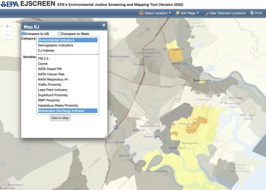
EPA’s Environmental Justice Screening and Mapping Tool
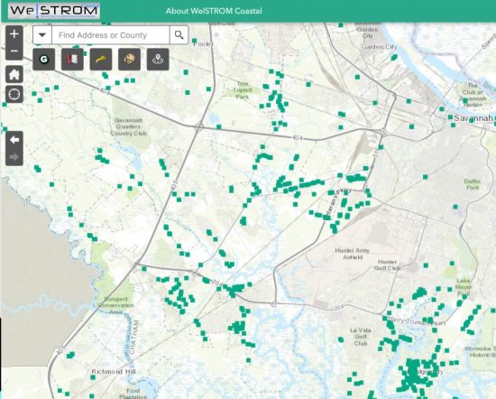
Data layers on water infrastructure, hazards, and public health vulnerabilities in Coastal Georgia. Pulls data from the Georgia Public Health Department.
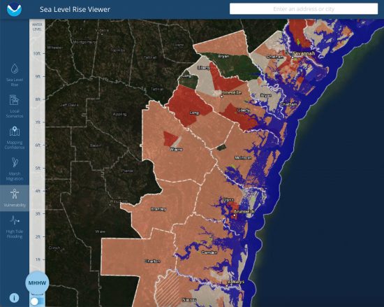
View different scenarios depending on the level of Mean Higher High Water forecasted in the future.
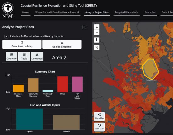
National Fish and Wildlife Federation Coastal Resilience Evaluation and Siting Tool (CREST)
CREST is used to make informed decisions about the siting of coastal restoration and resilience projects.
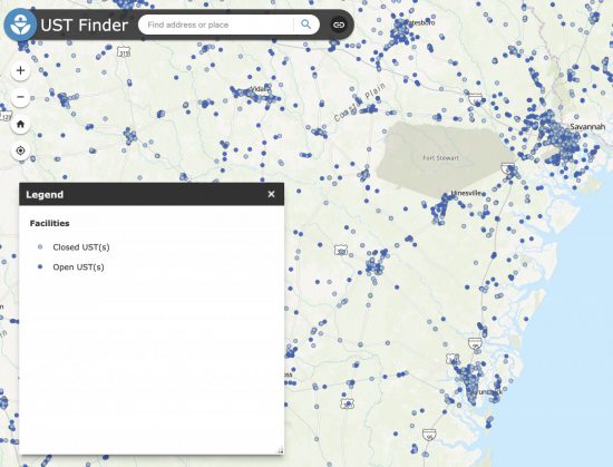
USEPA Underground Storage Tank Finder
Underground Storage Tanks are often a source of groundwater and well water pollution when maintenance is neglected.
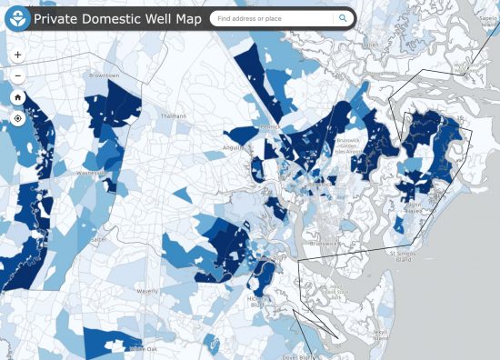
USEPA Private Domestic Well Map
This map details Private Domestic Wells by census track across the United States.
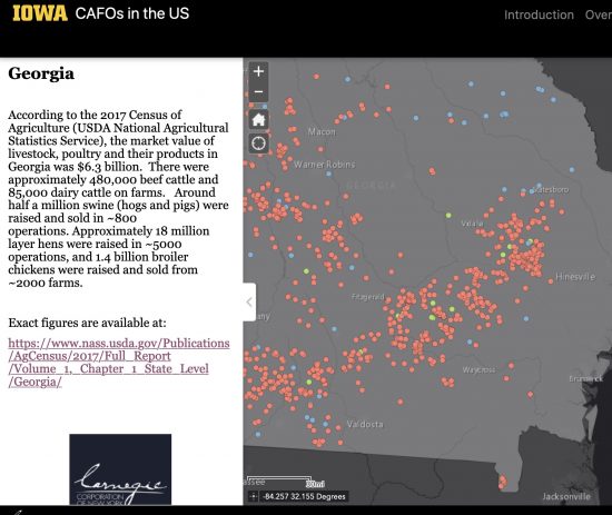
Concentrated Animal Feeding Operations can be a source of drinking water pollution and runoff if not operated properly.
Last updated: 6/13/2022